
 Log in





Review an aerial roof outline before the field check
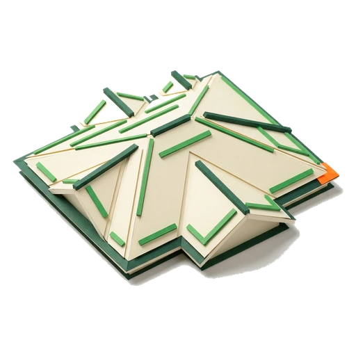
This is an example, built from a sample roof. Use it to see the building we picked, the eave, ridge and valley lines we drew, and where the field check comes in. It is not a result for a real property. It is not a measurement, it did not come from a provider, and no laser survey (LiDAR) was run on it.
What you will do
- Make sure it is the right building
- Look at the sample lines
- Stop at the field-check boundary

Why a roof takeoff report matters in Florida
- Climbing every roof with a tape is slow and it is dangerous. The quote stalls while the homeowner talks to your competitor.
- Order a measurement from an outside vendor and you pay for each job. Then you wait for it to come back.
- You type the numbers by hand. The coverage rates are old. Both quietly eat the margin on the estimate.
- Your measurement sits in a separate tool. It never makes it onto the proposal, the permit, or the pay application.
Roofing is a race to the signed contract. The estimator who puts an accurate roof number in front of the homeowner first usually wins the job. Measuring by hand costs you days. So does waiting in a vendor's queue.
Florida roofs carry real risk. Steep pitches, tile, and salt air make climbing up to measure a safety question and a liability question. Pull the measurement from the job address and the ladder comes out of the quoting step.
The measurement is only useful if it is honest. A pitch that is quietly wrong, or an area we assumed, turns into short material or a blown margin. So every number has to say how we got it, and whether it still needs a field check before you order.
A takeoff that stays attached to the job (and feeds your priced estimate) beats a loose PDF. The point is that the measurement lands in the proposal. Not one more file in one more inbox.
How to review the aerial takeoff boundary

- 1
Confirm the intended building
Use the outline only to confirm that you are looking at the intended structure. The public image is an illustrative review pattern, not a result for a real property.
- 2
Read the imagery boundary
The image is labeled Licensed reference. It does not prove anything about the roof.
- 3
Look at the sample lines
Review the example eave, ridge, and valley linework. The image does not prove pitch, facets, segment lengths, roof area, waste, or material quantities.
- 4
Check the analysis boundary
The example says LiDAR not evaluated, in so many words. It shows no measured coverage. It shows no finished analysis, no estimate, and no generated report.
- 5
Stop at the field-check boundary
The public example says Field check required. Go confirm the building and the roof conditions on site. Confirm the linework and every count before you price it or order material.
What the report tells you, and what to verify

- Every result says how we got it. A MEASURED stamp carries the LiDAR survey source and the flight year. An ESTIMATE stamp means it came from a building footprint and an assumed pitch. We never show an estimate as a measurement. So you know which one you have before you price the job.
- A footprint-only result is a flat estimate drawn from public building data. That data is Microsoft Building Footprints (ODbL), with FEMA/ORNL USA Structures (CC BY 4.0) as backup. A LiDAR result names its survey and the year it was flown. If the roof may have changed since that flight, we say so.
- Every output says to check on site before you order material. A takeoff report helps you estimate. It does not replace a final field check on a Florida roof.
- Measured analysis depends on three things: your account, your plan allowance, and coverage at the address. Where coverage is thin, FL Permit Pay keeps the result labeled an estimate or a review item. It never calls it measured.
Common questions
How accurate is an aerial roof takeoff report, and can I order material straight from it?

Measured results use Florida's public laser surveys for pitch, facets and slope-true area. Every report tells you to check on site before you order material. It also flags when a roof may have changed since the survey flight year.
Do I still need to climb the roof to measure it?
For the measurement itself, no. Drop a crosshair on the roof from the job address. Take a photo we have scaled. Then run the LiDAR, or draw the takeoff right on the photo. No ladder. We still recommend a final check on site before you order material, above all on a complex or changed roof. The report is an estimating aid and the field-verification checklist sheet says so.
What data does the report use for Florida roofs?
LiDAR results come from Florida's public laser height surveys. Each one carries its survey source and its flight year. When LiDAR does not cover an address, the report falls back to a labeled footprint estimate built from public building data. That is Microsoft Building Footprints under ODbL, with FEMA/ORNL USA Structures under CC BY 4.0 as the backup. Saved imagery keeps its credit and its capture date on the job.
Can the takeoff numbers price the estimate automatically?
Put the takeoff next to your materials catalog. Each item carries its coverage rate, its waste, its cost and your margin. Read the counts, then add the lines you want to the proposal.
Put the guide to work.
Add a job with an address and confirm the right building. Then run an aerial roof takeoff if the property qualifies, and if your plan has a report left.